
After months of research, two weeks of gondola rides, muddy ridgelines, and more rifugio pit stops than I can count, I’ve got a real answer to which hiking trails in the Dolomites are actually worth your time. These are the best hikes in the Dolomites that Chris and I hiked, sore feet and all.
Some of these trails handed us postcard views without much effort. Others, like the rockslide-damaged stretch near Tre Cime, had me questioning every life choice that led to five sketchy footholds molded into a crumbling mountainside. I’m not usually a risk-taker, but I said a prayer and took the steps anyway. That’s the kind of trip Chris and I had, where no amount of research prepares you for the reality of the trail.
10 Best Hikes in the Dolomites
This page may contain affiliate links. If you choose to click on one of the links and then make a purchase, Just Wander More may earn a small commission. The commission is paid by the company at no extra expense to you. Read the full disclosure here.
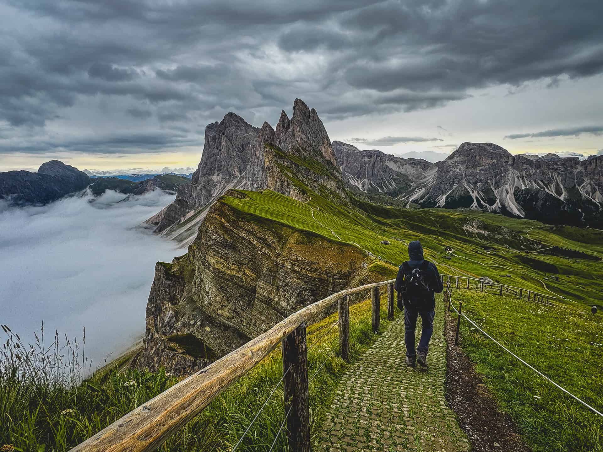
Chris and I built this list from two weeks on the ground in the Dolomites; we hiked every one of these trails together. For the full trip logistics, check out my Dolomites Itinerary, If you’re still in the planning stages, check out my tips for planning a trip to Italy. Chris and I swapped the planned Puez-Odle Altopiano route for Alpe di Tires once we were in Italy, most others were researched before we arrived.
We picked these ten because they’re the ones worth planning your whole day around: ridge walks with views that don’t quit, a via ferrata through WWI tunnels, and meadow loops that’ll make you forget your legs are tired. All of them are day hikes—no rifugio overnight required—based out of Ortisei, Colle Santa Lucia, or Castelrotto.
Hiking Trails in the Dolomites at a Glance
Before you dive into the table below, if you haven’t nailed down your gear, rifugio stops, or trip basics yet, my 10 Best Things to Know for Planning a Dolomites Hiking Trip post covers all of that. Here’s how the trails we hiked stack up:
| Hike | Home Base | Trail Type |
|---|---|---|
| Seceda Ridge Trail | Ortisei | Ridge walk with iconic views. |
| Alpe di Siusi Meadow Loop | Ortisei or Castelrotto | Flat meadow loop with sections of incline to the Mont Sëuc gondola base. |
| Puez-Odle Nature Park & Adolf Munkel Weg | Ortisei (40 min drive) | Nature park, forest & alpine meadow trail. |
| Tre Cime di Lavaredo | Colle Santa Lucia | Loop hike with steep drop-offs. |
| Cinque Torri | Colle Santa Lucia | Giant rock towers & WWI historical sites. |
| Mount Averau (from Rifugio Scoiattoli to Rifugio Averau) | Colle Santa Lucia | Northern WWI trenches up to Averau Saddle, Trail 441 along southern face with sheer drop-offs. |
| Rifugio Nuvolau | Colle Santa Lucia | Steep ridge hike to historic rifugio. |
| Rifugio Lagazuoi Via Ferrata | Colle Santa Lucia | Via ferrata through WWI tunnels. |
| Castelrotto Castle Ruins Walk | Castelrotto | Nature trail to castle ruins with significant incline at the beginning. |
| Alpe di Tires | Castelrotto or Ortisei | Mountain zigzag climb from Alpe di Siusi Meadow Loop. |
Day Hikes in the Dolomites: No Hut-to-Hut Required
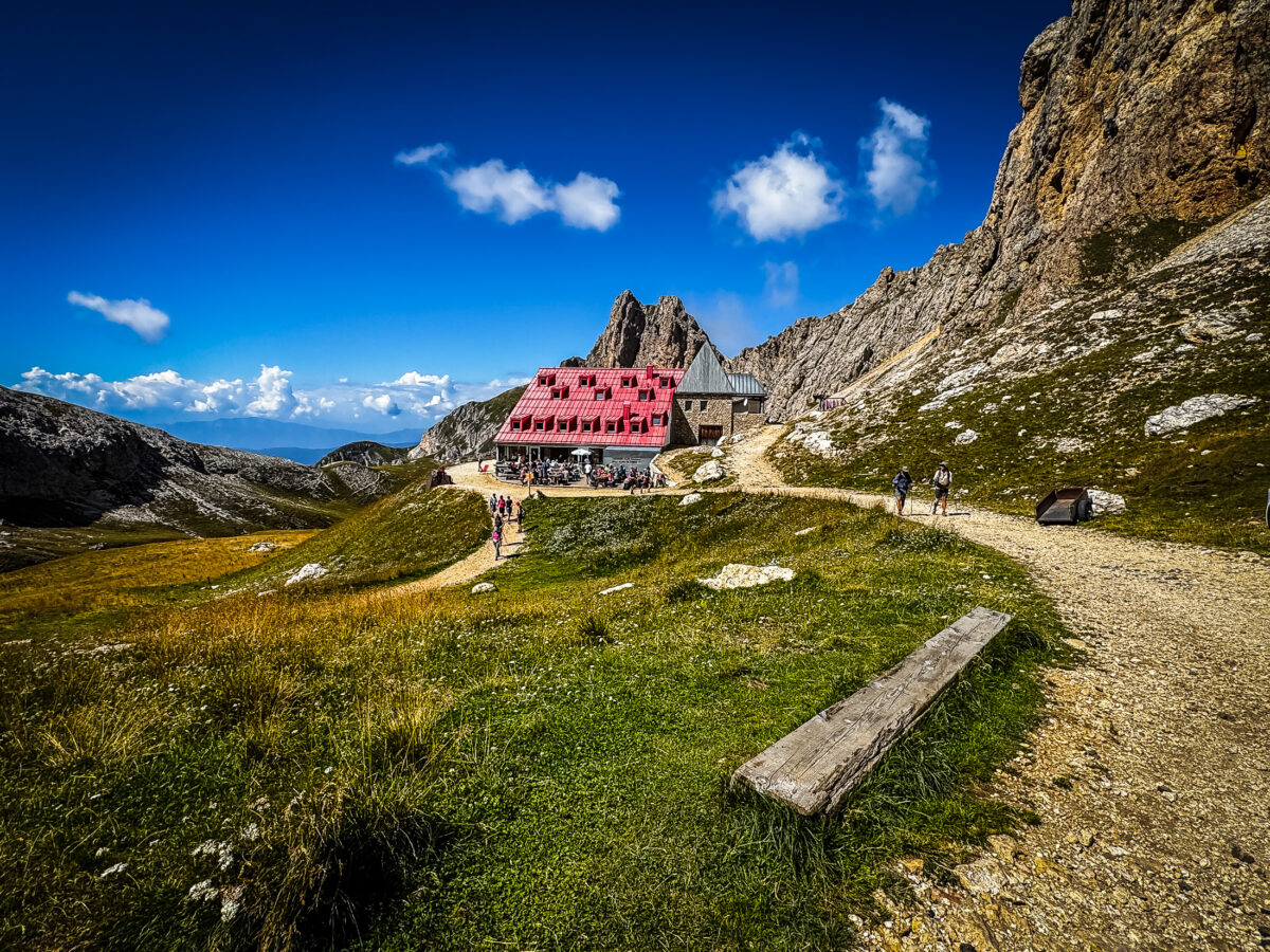
The Dolomites are famous for hut-to-hut hiking: multi-day routes such as the Alta Via trails where you carry your own gear and sleep in a different rifugio each night. It’s real backpacking, and a serious endeavor, since popular rifugi (singular: rifugio) book up months in advance.
Chris and I passed a couple on the trail who’d been doing the hut-to-hut route for a full week, logging over 9,800 feet (3,000 m) of elevation gain by the time we crossed paths. That’s not this list. Every hike below is a day trip you can do from one of three home bases: Ortisei, Colle Santa Lucia, or Castelrotto, no overnight gear or rifugio reservations required.
Don’t avoid the rifugi altogether though on your day hikes in the Dolomites. They’re a great place to stop for an authentic lunch, a well-earned dessert, restroom facilities, or a fun break, especially if a live band happens to be playing John Denver’s “Take Me Home, Country Roads.”
Tip * Bring cash. Many rifugi are far from the nearest ATM and do not accept credit cards, especially for a quick snack, drink, or even an overnight stay in a bunk.
Best Hiking in the Dolomites: Trail Difficulty & What to Expect
Dolomites hiking covers a wide range, from flat, well-marked meadow loops to narrow ridge trails with sheer drop offs. Trails are numbered and signed clearly, so navigation is rarely the hard part. What catches people off guard isn’t the distance or elevation gain, it’s the conditions: loose limestone scree underfoot and interwoven roots on the trail plus afternoon storms that roll in fast even on a clear morning.
Most of these hikes don’t require technical gear, but I highly recommend sturdy boots, wool socks, and trekking poles—poles make a real difference on the descents. One hike on this list, Rifugio Lagazuoi, runs through actual WWI tunnels, and gloves (garden gloves work fine) and a headlamp are enough to get through them. Chris and I skipped the harness and cable lock-ins entirely, though I get it if maneuvering steep, uneven steps in the dark isn’t your thing—lock in if that’s what gets you through comfortably.
1. Seceda Ridge Trail
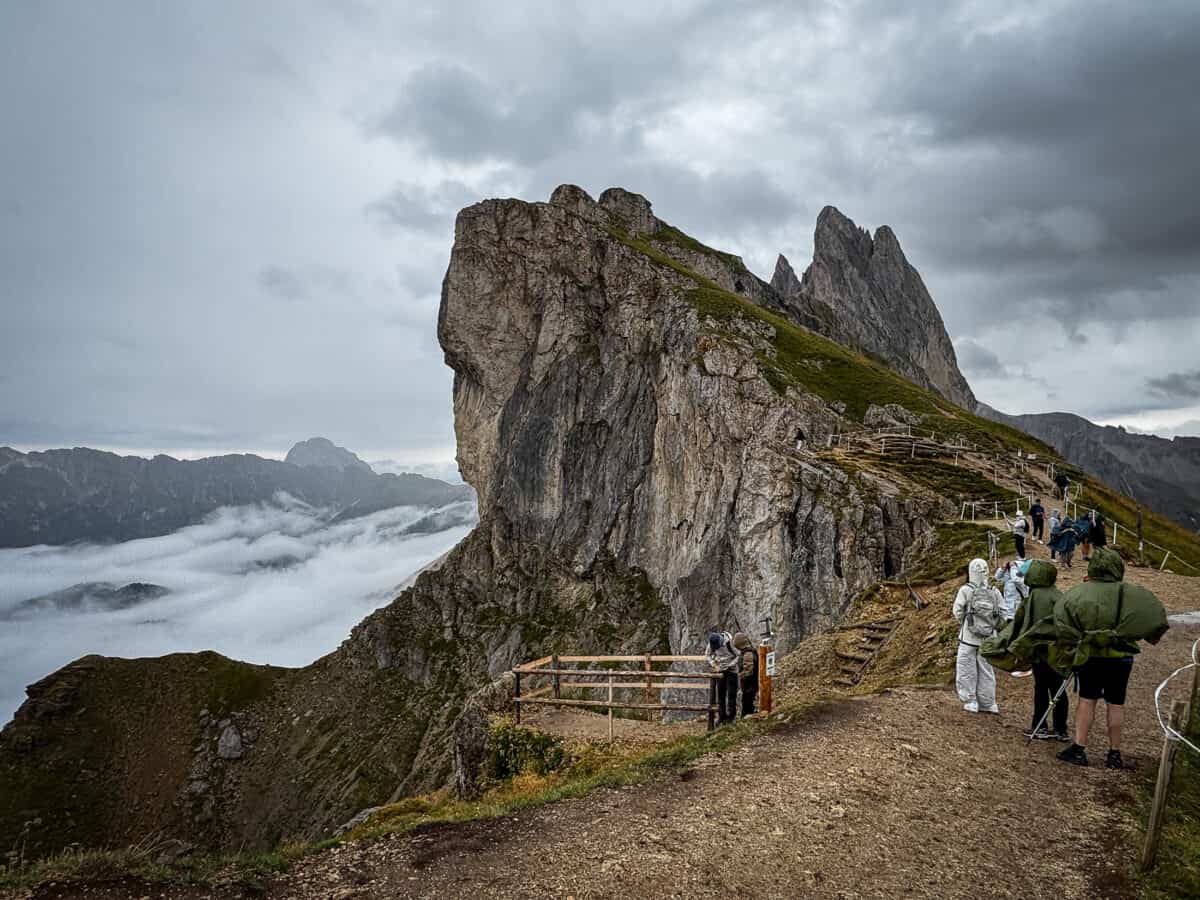
Seceda was our first hike in the Dolomites. The gondola ride up took about 20 minutes with a switch partway to a bigger car, and stepping out onto that ridge, even with rain moving in and tour groups already crowding the platform, I understood immediately why every Dolomites photo you’ve ever seen has this exact view in it.
Chris and I climbed up to the viewpoint along the Seceda Ridge, and the wind and cold hit fast enough that we were glad we’d packed puffy vests and rain jackets. The rain began in earnest as we started down the ridge trail itself, and the path turned to mud fast enough that we turned around rather than push on. If you get a clear morning here, you’ll discover more of the ridge than we did.
- Difficulty: Moderate
- Distance: 2.8 miles (5 km)
- Elevation Gain: 1,161 ft (354 m)
- Best Time to Visit: Early morning, before the clouds roll in
- Access: Seceda cable car from Ortisei, about €80 per person round trip (the priciest gondola of the whole trip)
Note * Some sites recommend buying your gondola ticket in advance during busy months. Reservations lock you into a specific time slot; you can’t ride the gondola more than 15 minutes before your reserved time, so plan your morning around it rather than trying to beat the crowds by arriving early. If you’re visiting in the off-season, a walk-up ticket is fine and you can skip the reservation altogether.
2. Alpe di Siusi Meadow Loop
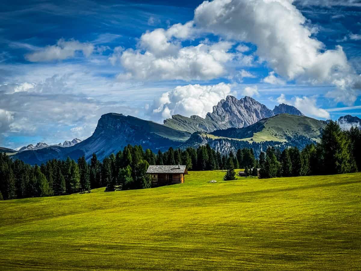
Alpe di Siusi is the payoff for anyone who’s ever pictured a Dolomites meadow hike: green pastures ringed by peaks, and barely any effort required to get the view. The Mont Sëuc gondola from Ortisei drops you right into it, and from there we picked a direction and just walked the full 8-mile loop, with the Schlern massif as a constant backdrop.
The only real climb of the day comes at the very end, a steady incline back up to the gondola station. Watch for the “Beware of Snakes” sign along the way—I’m fairly sure it’s just there to keep people off the grass.
- Difficulty: Easy-Moderate
- Distance: 8.6 miles (14 km)
- Elevation Gain: 1,304 ft (398 m)
- Best Time to Visit: Clear days for unobstructed Schlern views
- Access: Mont Sëuc gondola from Ortisei (or the Alpe di Siusi cable car from Castelrotto)
3. Puez-Odle Nature Park & Adolf Munkel Weg
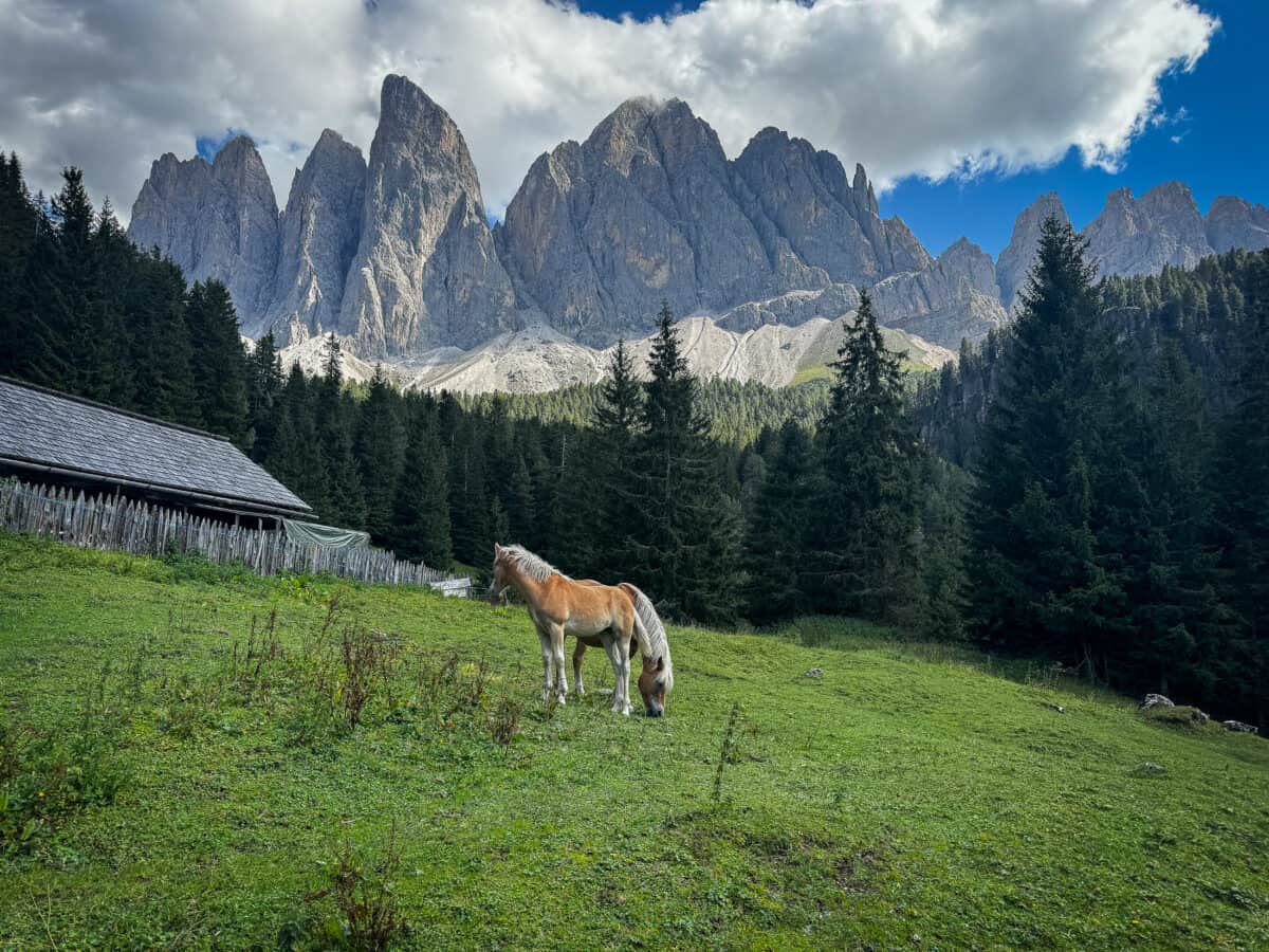
We started from the town of Runi rather than the Zans parking lot (it fills up quickly), adding about 1.5 miles each way. The first section on the official trailhead follows a road partway through Puez-Odle Nature Park—time it right and you’ll reach Gampen Alm for lunch. Join the Adolf Munkel Weg (walk) after leaving the rifugio. From there, the Geisler/Odle peaks flank the trail with plenty of ups and downs along the way.
- Difficulty: Moderate-Strenuous
- Distance: 11.6 miles (19 km)
- Elevation Gain: 2,844 ft (867 m)
- Best Time to Visit: Early morning starts, June–September for a snow-free trail
- Access: Arrive early as Zans parking lot fills up fast. If the lot is full, shuttle buses run from nearby villages.
4. Tre Cime di Lavaredo

Tre Cime di Lavaredo is one of the most iconic—and most crowded—hikes in the Dolomites, so book your parking reservation weeks ahead or plan on the shuttle. We did the full loop around the “Three Peaks”, sticking to the quieter upper trail instead of the popular lower path below it. About halfway through, a rockslide had wiped out the trail, leaving only a handful of sketchy handmade footholds bridging the gap; I said a heartfelt prayer and crossed it. The reward on the far side was Rifugio Dreizinnenhütte and a pair of alpine lakes tucked behind the peaks.
- Difficulty: Moderate-Strenuous
- Distance: 9.2 miles (15 km)
- Elevation Gain: 3,407 ft (1,039 m)
- Best Time to Visit: You can enter anytime within 12 hours after your reservation, but not earlier, so book the earliest slot available to beat the crowds. Shuttle options also available.
5. Rifugio Nuvolau
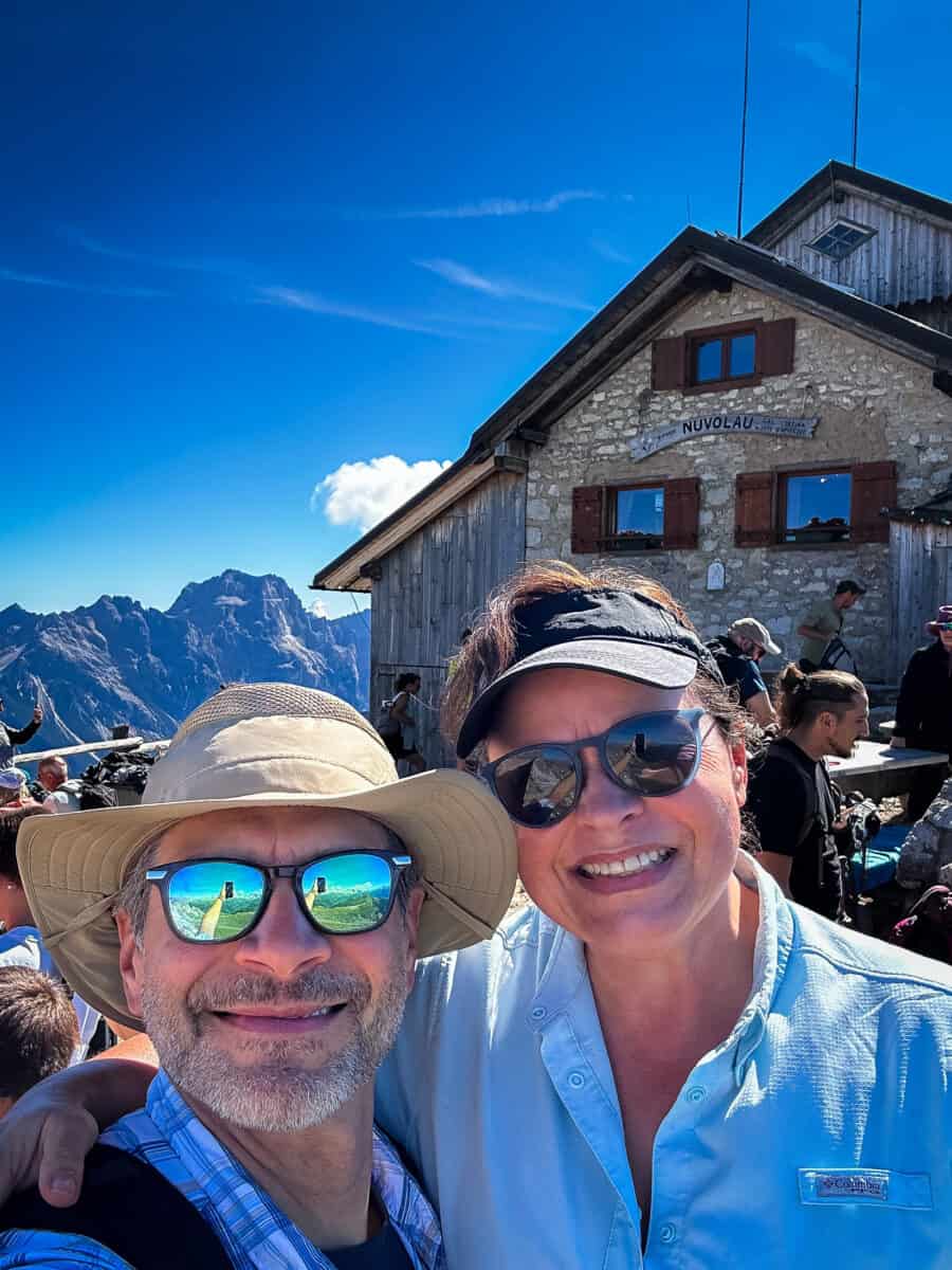
Rifugio Nuvolau is the oldest mountain hut in the Dolomites, built in 1883 and perched on a rock outcrop with a 360-degree view of the peaks around Cortina. We’d actually tried to reach it earlier in the trip from the Passo Giau side, but turned back part way when the weather rolled in. This time we started here first, right off the chairlift from Rifugio Averau, before working our way down to Cinque Torri and Mt. Averau.
Don’t expect solitude. This is one of the most popular stops in the area, with a steady stream of hikers climbing up and down the mountain all day. It’s not a hut you’ll have to yourself, but the view is worth it.
- Difficulty: Moderate
- Distance: 0.6 miles (1 km) one way
- Elevation Gain: 531 ft (162 m) one way
- Best Time to Visit: Morning, before afternoon clouds build over the peaks
- Access: Fedare chairlift to Rifugio Averau, then continue on the trail toward Nuvolau
6. Cinque Torri
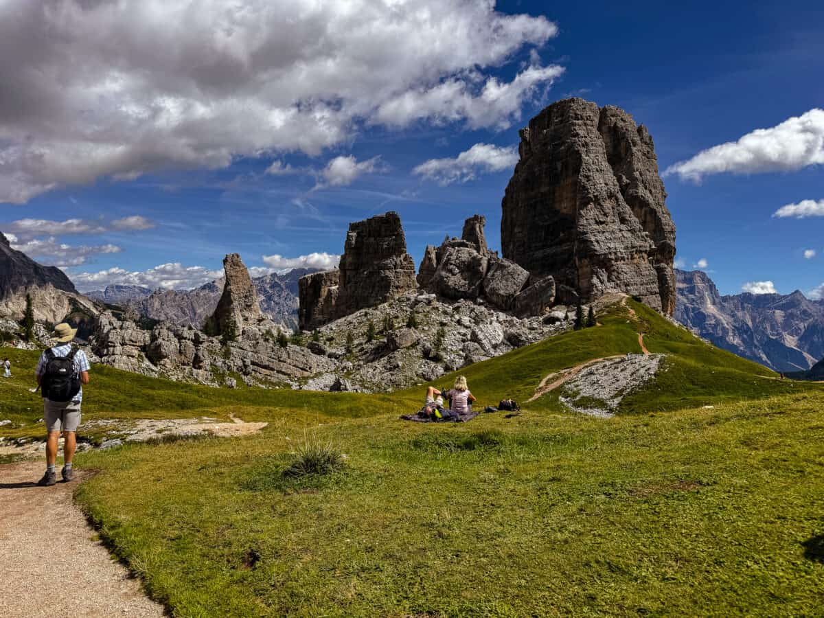
Cinque Torri, literally “Five Towers,” is one of the most photographed spots in the Dolomites, and one of the easiest to reach. The first half of the loop winds through a WWI open-air museum, complete with restored trenches, bunkers, and even mannequins staged the way soldiers actually fought at this altitude. From there, the trail continues into the rock towers themselves, with Averau and Nuvolau rising just beyond. We did all three hikes in one day to maximize the chairlift ticket: Rifugio Nuvolau first, then Cinque Torri, finishing with Mount Averau.
- Difficulty: Easy
- Distance: 2.5 miles (4 km)
- Elevation Gain: 330 ft (100 m)
- Best Time to Visit: Chairlift runs June–October; go early to beat the crowds and tour buses
- Access: Rifugio Fedare chairlift (the quieter option, versus the busier lift from Baita Bai de Dones to Rifugio Scoiattoli)
7. Mount Averau
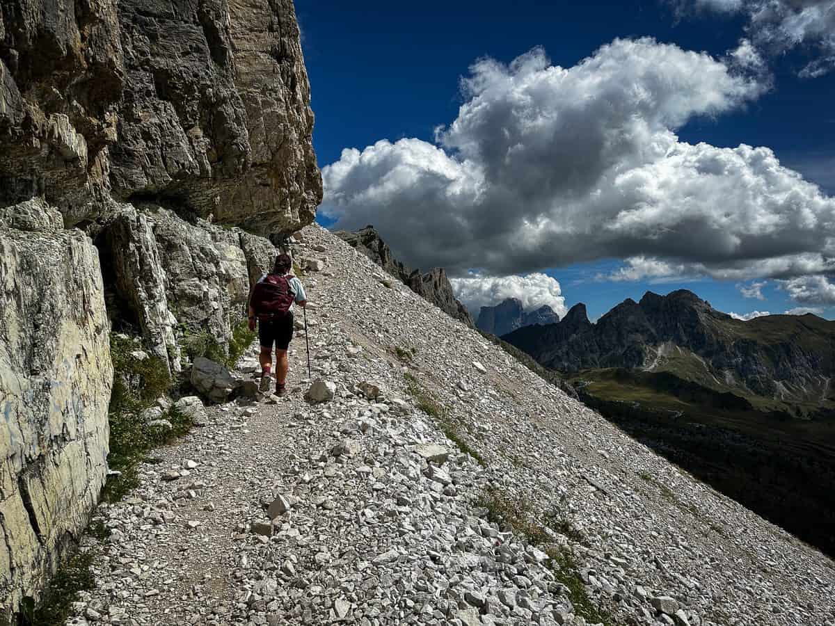
Mt. Averau is the highest peak in the Nuvolau Group at 8,691 feet (2,649 meters), an unmistakable square block of rock that stands out even among the Dolomites’ oddly shaped summits. A marked trail leads around the mountain from Rifugio Averau, short but steep enough to earn the view. We saved this for last on our three-hike day, tired but glad we’d timed the chairlift right.
- Difficulty: Moderate
- Distance: 1.9 miles (3 km)
- Elevation Gain: 755 ft (230 m)
- Best Time to Visit: Morning before afternoon clouds build over the peaks
- Access: Fedare chairlift to Rifugio Averau, then follow the marked trail around the mountain
8. Rifugio Lagazuoi Via Ferrata
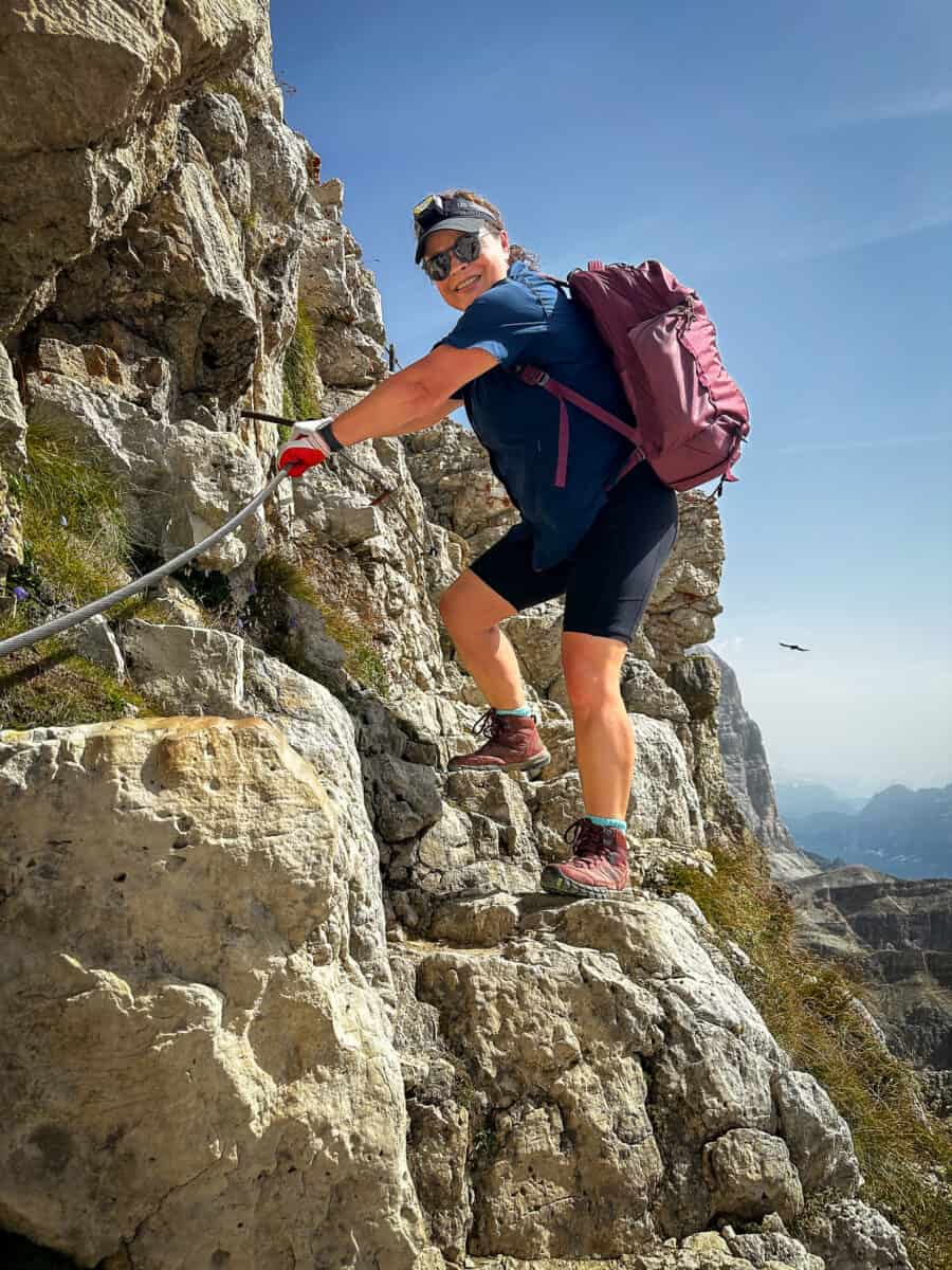
Rifugio Lagazuoi sits atop a maze of WWI tunnels carved inside the mountain. The classic way to experience them is to ride the cable car up from Passo Falzarego, then descend through the tunnels on foot. We skipped the harness and lanyard some people use on the via ferrata sections; all we needed were gloves and headlamps. You WILL need some type of lightsource. The tunnels themselves are a strange, cold walk through history down steep, uneven steps with a via ferrata cable to guide your steps.
- Difficulty: Easy-Moderate
- Distance: 2.5 miles (4 km), top to bottom
- Elevation Loss: 2,133 ft (650 m)
- Best Time to Visit: Cable car runs roughly June–October; go early for fewer people in the tunnels
- Access: Lagazuoi cable car up (rent a helmet at the base station if you want one for the tunnels—otherwise just watch your head), then down through the Galleria del Lagazuoi tunnel, connecting to trail #402 back to Passo Falzarego.
9. Castelrotto Castle Ruins Walk

From our hotel in Castelrotto, we could see two castle ruins on the mountainside and decided to walk to them instead of driving anywhere that day. The first section was a steep climb to a castle ruin that wasn’t open for exploring, so we didn’t linger. The second castle sat along a family-friendly nature path with plenty of ups and down but great valley views. The walk ended at Laghetto di Fiè, a small lake packed with locals picnicking and swimming. We caught the bus back to town and finally took some time to relax by the pool at ArtNatur Dolomites Hotel.
- Difficulty: Easy-Moderate
- Distance: 6.65 miles (11 km)
- Elevation Gain: 1,351 ft (412 m)
- Best Time to Visit: Anytime in season; lower elevation than the other hikes on this list, so it’s a good pick if weather’s iffy up high
- Access: Trailhead at the Alpe di Siusi gondola base station near Castelrotto/Siusi
10. Alpe di Tires
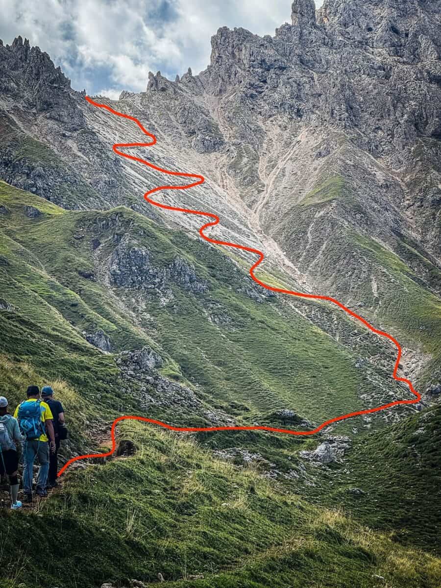
Alpe di Tires is a different kind of hike than the Alpe di Siusi Meadow Loop across the way: after the gondola ride up from Siusi to Compaccio, the trail climbs steadily before finishing in a series of steep, zigzagging switchbacks up a scree slope. Sassolungo and Sasso Piatto loom directly ahead the whole way, getting bigger with every switchback.
This was the last hike Chris picked for our trip, and I texted my daughters a photo of it captioned simply: “THIS! This is the last hike Dad picked for our Dolomites hiking trip!”
- Difficulty: Moderate-Strenuous
- Distance: 8.9 miles (14 km)
- Elevation Gain: 2,428 ft (740 m)
- Best Time to Visit: Clear mornings for unobstructed Sassolungo/Sasso Piatto views
- Access: Alpe di Siusi cable car (Seiseralmbahn) from Siusi to Compaccio, then the Panorama chairlift partway up, before continuing on foot to the switchbacks (you can also pick up this trail directly from the Alpe di Siusi Meadow Loop).
Dolomites Hiking Etiquette
South Tyrol gets crowded, especially at the popular spots on this list, so a little trail etiquette goes a long way.
Hiking Etiquette Tips
- Use a restroom, not the trail. Rifugios have facilities (bring coins, some charge a small fee), and it should go without saying: never poop in the WWI tunnels, never at a scenic overlook. If you’re caught between rifugios, pack it out.
- Greet people. We heard all kinds of greetings on the trail: “Buongiorno,” “Ciao,” “Servus,” “Giorno,” even plain “Hello” and “Hi.” Whatever you’ve got, use it—locals and hikers greet everyone passing, not just people they know.
- Yield to uphill hikers. They’ve got momentum and less room to maneuver; step aside on narrow sections.
- Stay on the marked trail. Cutting switchbacks might save you thirty seconds and it tears up fragile alpine terrain that takes years to recover.
- Respect the pastures. Many trails cross grazing land. Close gates behind you and give the cows and horses their space.
- Stop at the rifugios. Most are cash only. If you sit at a table or use the restroom, order something.
- Leave the history alone. The WWI tunnels and trenches are protected sites, not a place to pocket a “souvenir.”
- Move quickly through chairlift and gondola lines. Have your ticket or reservation ready before you’re at the front.
Italy Quick Facts
- Official Language: Italian
- Capital City: Rome
- Population: 58.9 million
- Currency: Euro (€ or EUR)
- Power Outlet: Type L (3 round prongs) is standard and Type C (2 round pins)
- Emergency Number: 112
- Drive on the: Right side of the Road

Frequently Asked Questions
What’s the best time of year to hike in the Dolomites?
Late June through September, with July and August giving you the most reliable weather and full lift/gondola operating hours. We went mid-August through early September and still hit a few rainy, socked-in days, so build in flexibility.
Do you need to be an expert hiker to enjoy the Dolomites?
No. Cinque Torri is the easiest, fully family-friendly with no technical sections. Alpe di Siusi Meadow Loop is beginner-friendly too, just know the final stretch back up to the gondola is a real, sustained climb, not the flat meadow walk the rest of the trail is.
Do you need hiking poles for these trails?
Not required, but recommended, especially for Alpe di Tires’ switchbacks and the loose scree on Seceda and Tre Cime. We used them on most hikes except inside the Lagazuoi tunnels, where you need both hands free for the cable.
Do you need via ferrata experience for Rifugio Lagazuoi?
Not for the route we did. The tunnels themselves are walkable without a harness; the true via ferrata sections are optional add-ons for people who want more exposure. Bring gloves and a headlamp either way.
Are reservations required for any of these hikes?
Yes, for Tre Cime di Lavaredo, you need a paid parking reservation booked in advance, or plan on the shuttle. Some chairlifts, like the one at Alpe di Siusi, also get busy enough that arriving early makes a real difference.
How many days do I need to hike the highlights on this list?
We spread these ten hikes across two weeks, but you could hit the highlights (Seceda, Alpe di Siusi, and Cinque Torri/Nuvolau/Averau in one day) in as few as four or five days.
Love this Post? Pin it!
Your Dolomites Hiking Bucket List Just Got a Glow Up
Ten hikes down, and I promise the views only get better every time you lace up. Whether you’re chasing sunrise at Seceda or bracing for the switchbacks at Alpe di Tires, half the battle is showing up with the right gear. Check my free Dolomites packing list before you go so you’re not scrambling for gloves and a headlamp at the last minute.
You may also love…
- Plan a Trip to Europe: 15 Essential Tips for First-Time Travelers
- Best Travel Backpack for Europe, Adventures & Hiking
- 15 Best Cities & Towns in Northern Italy You Need to Visit
- 15 Most Beautiful Places in Italy for Photographers
- 10 Best Things To Do in Cinque Terre on a Romantic Couples Getaway
- 30 Things to Do in Florence: Art, Food, & Epic Tuscany Day Trips
- Rome Travel Itinerary: 25 Unforgettable Things to See, Do & Explore
